Researchers from the UIB of the ACSIC group and the IFISC analyze the data collected by sports applications and make relevant information for urban planning and tourism
University of Balearic Islands
Parallel to the hatching of mobile devices, there has also been the popularization of sports applications that allow users to register the movement. A study by the ACSIC researchers at the University of the Balearic Islands together with the IFISC group proposes the use of the data collected through these sports applications to analyze human mobility and obtain indicators on the actual use of the network of routes and roads. From the perspective of the UIB researchers, knowing the patterns of human mobility can provide valuable information for policies of urban planning and tourism, actions in conservation and road signaling, or detection of areas lacking services, among other.
The study, published in the journal PLoS ONE, states that activity records of these sports applications, especially GPS-registered routes, can be transformed into complex networks that represent routes in terms of road intersections and the different seasons of the year.
The data set covers the territory of the Balearic Islands between 2009 and 2016. The topological features of these complex networks give an idea of how a particular group of routes are used and related, and make it possible to detect regions of significant importance in every season of the year.
The study shows that spring and summer are the seasons with a greater contrast in the practice of hiking, which affects the location and frequency of activities. In addition, the existence of signposted routes, such as trails of great distance or GR (the GR 221 or Ruta de la piedra en seco and the GR 222 or Ruta Artà-Lluc, in Majorca, and the GR 223 or Camí de Cavalls, en Menorca), favor a higher frequency of activities. In general, the municipality of Escorca, the reservoirs of Cúber and the Gorg Blau and the towns like Esporles or Valldemossa are the zones with more activity in Majorca; in Menorca, stands out the Camí of Cavalls; while in Ibiza the routes are distributed more evenly across the territory.
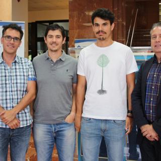
The UIB researchers who participated in this study are Isaac Lera, Carlos Guerrero and Carlos Juiz, from the research group Architecture and Performance of Computer and Communications Systems (ACSIC) of the Department Computer Sciences, together with Toni Pérez and Víctor M. Eguíluz, from the Institute of Interdisciplinary Physics and Complex Systems (IFISC, CSIC-UIB).
Bibliographic reference
Isaac Lera, Toni Pérez, Carlos Guerrero, Víctor M. Eguíluz & Carlos Juiz. «Analysing human mobility patterns of hiking activities through complex network theory», PLoS ONE, 12(5): e0177712. https://doi.org/10.1371/journal.pone.0177712
Event date: 08/06/2017
Publication date: Thu Jun 08 13:41:00 CEST 2017
